Arizona Agriculture Using Technology to Save Ecosystems
Published
8/19/2013
Recently, scientists at the U.S. Department of Agriculture (USDA) reported deploying tools that can help ranchers and land managers protect native ecosystems and control invasive vegetation more economically and efficiently.

Through aerial photography and computer programs, ranchers can quickly identify and measure areas affected by invasive trees. Developed by USDA scientists Kirk Davies and Matt Madsen, the technology identifies and collects information to determine coverage of a specific species.
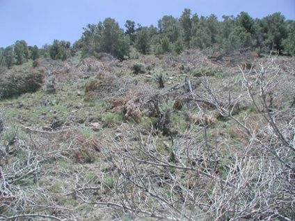
According to a USDA report, the expansion of western juniper trees on some arid U.S. rangelands is pushing out other plant species, reducing sagebrush habitat and livestock forage, and at times fueling catastrophic wildfires. Davies and Madsen, who work at the Eastern Oregon Agricultural Research Center in Burns, Oregon, led studies on using National Agricultural Imagery Program (NAIP) high-resolution aerial images to estimate western juniper cover over a 30,500-acres area in Idaho.
Using this approach, the team attained a tree cover classification overall accuracy rate of 92%.
Here in Arizona, our ranchers suggest they’ll endorse any technology as long as it helps improve rangelands for grasses and to reduce forest fires.
Rancher Mark Carlisle of Bar M Ranch, west of Snowflake, Arizona jokingly says, “As long as it doesn’t add more work.”
Referring to how enabling some of the most basic technology can be on behalf of Arizona agriculture he adds, “Today you can use Google Earth to see what invasive species have been eradicated. This satellite imagery
Ultimately, preserving ecosystems and protecting wildlife and livestock are a priority among our Arizona ranchers. “More forage for the wildlife and cattle and less wildfire risk means a better system all around,” says Carlisle.
Mark Carlisle’s dad, Jack, adds another caveat. “Because of these juniper control programs and the forward-thinking efforts of many, we’re grateful for what others have helped us achieve.”
Jack further explained that through the use of crop conservation grant programs, NRCD and collaborative efforts as ranchers; they’ve been able to improve the rangelands in their area. “We need to thank somebody.”
And while technology aids in efforts for better land management, chair of Coconino NRCD reminds us that technology is not the ultimate fix. “Remember that we’re talking about large landscapes,” says Michael Macauley. “You’re dealing with square miles, not square inches. Walking still gives you the opportunity to check the soil. So there’s a trade-off. There is no panacea; no fix, no end all and be all.”
Regardless, a robust partnership exists between land managers, ranchers, scientists and others for improved rangelands. Technology can enhance the partnership.
Perhaps they all need to be thanked: The ranchers, the NRCD, land managers, scientists and all stakeholders in ensuring an enduring legacy in our American and Arizona rangelands.